 |
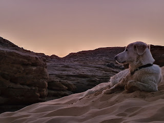
| Sun rises over the Temple of Sobek |
Since the initial survey of the
Temple of Sobek at Gebel el-Silsila in 2015, the Mission has discovered a
connected temple structure towards the Nile containing sandstone foundations, a
mudbrick surrounding, and a unique circular shaft nicknamed the “pit of Sobek”.
During the excavations thousands of fragments from the destroyed temple were
recovered, including raised relief limestone, raised and sunken relief
sandstone, stamped mudbrick and a great variety of religious artefacts and
daily ware.
Summary of work so far
The Temple of
Sobek (Temple of Kheny/Khenu) is situated on a sandstone outcrop, once holding
structures build from sandstone, limestone and with details in granite and
mudbrick, located along the northern boundary of Gebel el-Silsila east, just below the colonial pump station, and neighbouring the modern canal to the
south. The temple borders agriculture
land to the east and north, and the River Nile to its west. The main structure
has a west-east axis, with its main entrance opening to the west (i.e. from the
Nile). Not much was known about the temple until 2015, when the Mission carried
out an initial survey.
 |
| Pit of Sobek |
The
temple was completely dismantled during antiquity, down to its foundation
blocks. However, during the excavations, the foundations and bedrock footprints
were exposed, revealing a temple structure of approximately 35 x 18 m, which
included four dressed floor levels, column bases, and indications of inner and
outer walls. The remains of five dressed and raised column bases were located
in the temple’s western partition, each measuring approximately 1.40 m in
diameter and located 3.20 m apart, 8.40 m across. To the east of the column
bases are two dressed and raised squared areas, presumably indicating the
architectural divide within the structure (pronaos).
Further to the east and placed centrally, is a raised and dressed platform. It
is surrounded by dressed surface, parts of which have received linear
positioning/indication marks (single and double incised marks) that run in an
easterly to westerly direction, and indicate the position of interior and
exterior walls, including the walls of four chambers, with each room measuring
approximately 3.10 – 3.20 m wide. The exterior walls generally follow natural
fractures and formations in the bedrock. The outskirts of the northern exterior wall are inscribed with foot
graffiti located adjacent with Predynastic petroglyphs and cupules.
 |
| commemorating soles at the Temple of Sobek |
The
area to the west had never been surveyed or excavated before. Similar to the
main temple, the objectives of these excavations are to estimate the absolute
temple boundaries, establish its various chronological phases together with
potential diverse uses, understand when and why the sanctuary was abandoned,
and how it relates with contemporaneous architecture and infrastructure on
site. The study is also closely connected with the Mission’s excavations of the
adjacent necropolis in that they equally generate a view of the ancient life
the people of Kheny experienced. Such results can be reached through the
integrated analysis of religious practices and material culture. In a larger
picture, the results can be compared with previous research into quarry
activity and life all together at Gebel el-Silsila.
 |
| Excavating the western part of the temple. Photo by A. Andersson |
According
to local farmers, the area was flooded annually until the 1970’s, resulting in
the accumulation of a large pile of silt and sand debris around a large
tamarisk tree. Mixed in the debris and scattered on the surface were large
amounts of Roman ceramic sherds; and prior to excavation the team found
fragments of painted and dressed sandstone and limestone, equivalent with
material documented in the main temple. The mound of silt and debris rose to
several meters above the natural sandstone slope. Simplified, its stratigraphy
consisted of five main layers, listed from above to below:
1) upper
stratum of modern debris (mainly remnants from the making of the new canal);
2) middle layer
of ancient tumbled debris (sandstone, limestone, pottery, etc.);
3) lower level
of pure Nile silt brought by the annual inundation (which at the centre of the
pile contained annual shedding of the tamarisk tree);
4) linear, n-s
oriented series of dressed sandstone blocks, surrounded by levels of crushed,
reused limestone fragments (north) and a mud-brick structure abutting the sandstone foundation blocks (south and west)
5) bedrock.
 |
| top, modern layer |
The central area contained evidence
of a Roman kiln (approximately reign of Antonius Pius), surrounded by large
amounts of pottery sherds from this period. Intermingled with the pottery was a
varied combination of items associated with everyday use, such as fishhooks,
nails, animal bones (mainly catfish), etc. The Roman layer also contained a
significant amount of fragments from the original temple, including decorated
and dressed sandstone and limestone details, fragments of sandstone flooring,
and artefacts indicating cultic life, such as a small votive of a crocodile.
 |
| Limestone fragments, reused in later filling |
Roman kiln layer
In
the central area, and below the kiln level, we cleared a rock hewn circular structure
at 6 meters deep into which numerous fragments from the original temple had
been disposed. Several limestone fragments contained raised relief decoration
and hieroglyphic text, although in a poor state of preservation. To the
north-east of the circular structure we discovered fragments of a sandstone
door, including its lintel, with hieroglyphic inscriptions from the reigns of
Amenhotep III and Ramses II respectively. A sandstone fragment of a left
doorjamb contained the Horus-name of Ramses II, while the title of Sobek, as
“Lord of Kheny”, appeared on another. Footprints of another door (doorpost and
semi-circular wear grooves) were found in the southern part of the sandstone
structure, surrounded by mudbrick of 18th Dynasty measurements.
Excavation work showed that the mudbrick structure was aligned with the
sandstone foundation blocks, and is currently believed to have had a function
of an embankment. The archaeological work has now connected the western
structure with the main temple, and thereby allowing an estimation of the
sanctuary’s greater extension.
 |
| Pit of Sobek |
Methods
The method of
excavation is to remove the surface layer, following the bedrock where exposed,
or remaining blocks. The area is documented by means of photogrammetry pre-,
para-, and post-excavation, combined with traditional archaeological recording
techniques, photography and GIS mapping.
 |
| Normal day at work... |
Season 15 archaeological work
The work consisted of a continuous
investigation in and around the pit of Sobek, including the recovery of
dressed, painted and architectural elements from the destroyed temple. The
gate/pylon area was explored further, as was the investigation to the south of
the hypostyle hall. The main effort, however, laid on the investigation of the
eastern boundary of the temple in agreement with the orders given by the
inspectorate of Aswan and Gebel el-Silsila. There, the Mission discovered the
foundation blocks of the south-east corner and the continuing eastern part of
the sandstone enclosure wall along with fragments of the main cult statue
(Sobek) and the statuary face of an 18th Dynasty pharaoh. In
addition, work was carried out regarding the removal and landscaping to the
external areas of the temple, redefining the boundaries of the temple to the
north and east, and the initiation of the construction of a temporary wall to
the northern and eastern boundaries. All work in the temple involved daily
archaeological documentation, photography, and photogrammetry, and all temple
artefacts and stone fragments were registered.
 |
| Limestone fragment of main cult statue |
 |
Head of 18th Dyn Pharaoh
 |
 |
the love for stratigraphy...
|


