Showing posts with label 18th dynasty. Show all posts

Friday, March 04, 2022

Updates from the Temple of Sobek

Sun rises over the Temple of Sobek


Since the initial survey of the Temple of Sobek at Gebel el-Silsila in 2015, the Mission has discovered a connected temple structure towards the Nile containing sandstone foundations, a mudbrick surrounding, and a unique circular shaft nicknamed the “pit of Sobek”. During the excavations thousands of fragments from the destroyed temple were recovered, including raised relief limestone, raised and sunken relief sandstone, stamped mudbrick and a great variety of religious artefacts and daily ware.

Summary of work so far

The Temple of Sobek (Temple of Kheny/Khenu) is situated on a sandstone outcrop, once holding structures build from sandstone, limestone and with details in granite and mudbrick, located along the northern boundary of Gebel el-Silsila east, just below the colonial pump station, and neighbouring the modern canal to the south.  The temple borders agriculture land to the east and north, and the River Nile to its west. The main structure has a west-east axis, with its main entrance opening to the west (i.e. from the Nile). Not much was known about the temple until 2015, when the Mission carried out an initial survey.

Pit of Sobek

The temple was completely dismantled during antiquity, down to its foundation blocks. However, during the excavations, the foundations and bedrock footprints were exposed, revealing a temple structure of approximately 35 x 18 m, which included four dressed floor levels, column bases, and indications of inner and outer walls. The remains of five dressed and raised column bases were located in the temple’s western partition, each measuring approximately 1.40 m in diameter and located 3.20 m apart, 8.40 m across. To the east of the column bases are two dressed and raised squared areas, presumably indicating the architectural divide within the structure (pronaos). Further to the east and placed centrally, is a raised and dressed platform. It is surrounded by dressed surface, parts of which have received linear positioning/indication marks (single and double incised marks) that run in an easterly to westerly direction, and indicate the position of interior and exterior walls, including the walls of four chambers, with each room measuring approximately 3.10 – 3.20 m wide. The exterior walls generally follow natural fractures and formations in the bedrock. The outskirts of the northern exterior wall are inscribed with foot graffiti located adjacent with Predynastic petroglyphs and cupules.

commemorating soles at the Temple of Sobek

The area to the west had never been surveyed or excavated before. Similar to the main temple, the objectives of these excavations are to estimate the absolute temple boundaries, establish its various chronological phases together with potential diverse uses, understand when and why the sanctuary was abandoned, and how it relates with contemporaneous architecture and infrastructure on site. The study is also closely connected with the Mission’s excavations of the adjacent necropolis in that they equally generate a view of the ancient life the people of Kheny experienced. Such results can be reached through the integrated analysis of religious practices and material culture. In a larger picture, the results can be compared with previous research into quarry activity and life all together at Gebel el-Silsila.


Excavating the western part of the temple. Photo by A. Andersson


According to local farmers, the area was flooded annually until the 1970’s, resulting in the accumulation of a large pile of silt and sand debris around a large tamarisk tree. Mixed in the debris and scattered on the surface were large amounts of Roman ceramic sherds; and prior to excavation the team found fragments of painted and dressed sandstone and limestone, equivalent with material documented in the main temple. The mound of silt and debris rose to several meters above the natural sandstone slope. Simplified, its stratigraphy consisted of five main layers, listed from above to below:

1) upper stratum of modern debris (mainly remnants from the making of the new canal);

2) middle layer of ancient tumbled debris (sandstone, limestone, pottery, etc.);

3) lower level of pure Nile silt brought by the annual inundation (which at the centre of the pile contained annual shedding of the tamarisk tree);

4) linear, n-s oriented series of dressed sandstone blocks, surrounded by levels of crushed, reused limestone fragments (north) and a mud-brick structure abutting the sandstone foundation blocks (south and west)

5) bedrock.

top, modern layer


The central area contained evidence of a Roman kiln (approximately reign of Antonius Pius), surrounded by large amounts of pottery sherds from this period. Intermingled with the pottery was a varied combination of items associated with everyday use, such as fishhooks, nails, animal bones (mainly catfish), etc. The Roman layer also contained a significant amount of fragments from the original temple, including decorated and dressed sandstone and limestone details, fragments of sandstone flooring, and artefacts indicating cultic life, such as a small votive of a crocodile.


Limestone fragments, reused in later filling


Roman kiln layer

In the central area, and below the kiln level, we cleared a rock hewn circular structure at 6 meters deep into which numerous fragments from the original temple had been disposed. Several limestone fragments contained raised relief decoration and hieroglyphic text, although in a poor state of preservation. To the north-east of the circular structure we discovered fragments of a sandstone door, including its lintel, with hieroglyphic inscriptions from the reigns of Amenhotep III and Ramses II respectively. A sandstone fragment of a left doorjamb contained the Horus-name of Ramses II, while the title of Sobek, as “Lord of Kheny”, appeared on another. Footprints of another door (doorpost and semi-circular wear grooves) were found in the southern part of the sandstone structure, surrounded by mudbrick of 18th Dynasty measurements. Excavation work showed that the mudbrick structure was aligned with the sandstone foundation blocks, and is currently believed to have had a function of an embankment. The archaeological work has now connected the western structure with the main temple, and thereby allowing an estimation of the sanctuary’s greater extension.

Pit of Sobek

Methods

The method of excavation is to remove the surface layer, following the bedrock where exposed, or remaining blocks. The area is documented by means of photogrammetry pre-, para-, and post-excavation, combined with traditional archaeological recording techniques, photography and GIS mapping.

Normal day at work...


Season 15 archaeological work

The work consisted of a continuous investigation in and around the pit of Sobek, including the recovery of dressed, painted and architectural elements from the destroyed temple. The gate/pylon area was explored further, as was the investigation to the south of the hypostyle hall. The main effort, however, laid on the investigation of the eastern boundary of the temple in agreement with the orders given by the inspectorate of Aswan and Gebel el-Silsila. There, the Mission discovered the foundation blocks of the south-east corner and the continuing eastern part of the sandstone enclosure wall along with fragments of the main cult statue (Sobek) and the statuary face of an 18th Dynasty pharaoh. In addition, work was carried out regarding the removal and landscaping to the external areas of the temple, redefining the boundaries of the temple to the north and east, and the initiation of the construction of a temporary wall to the northern and eastern boundaries. All work in the temple involved daily archaeological documentation, photography, and photogrammetry, and all temple artefacts and stone fragments were registered.

Limestone fragment of main cult statue


Head of 18th Dyn Pharaoh


the love for stratigraphy...


Thursday, October 03, 2019

Celebrating Tutankhamun: Silsila excavations

CELEBRATING TUTANKHAMUN:excavations of a workers’ village at Gebel el-Silsila


Summary
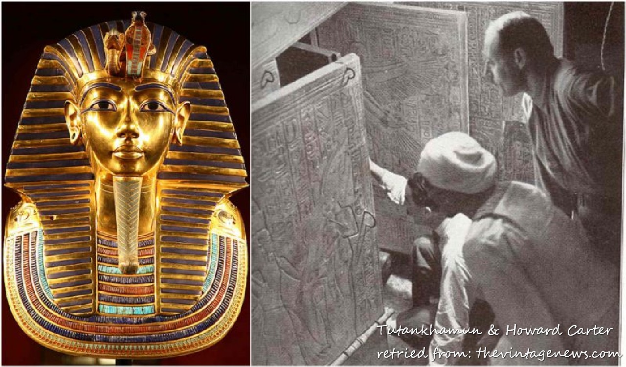
With the upcoming 100-year jubilee since Howard Carter’s opening of Pharaoh Tutankhamun’s tomb in Valley of the Kings in 1922, the Silsila Team would like to celebrate the golden boy-king and his family, by exploring for the first time, a workers’ village and quarry, dedicated to and marked with his name. The results of the survey and excavation work are to be presented and published in a monograph in 2022, coinciding with the Tutankhamun Jubilee celebrations, in Egypt and the world. The study includes an important and critical Middle Kingdom (c 2040-1782 BCE) fortress overlooking the Nile and guarding the border to Nubia. Funding for the season is already mainly at hand, with the exception of 10,000 Euro  that is needed to cover the rental costs of our dig house and some basic archaeological equipement: the goal for this crowdfunding campaign is to raise funds to cover these costs. Any amount over the goal will go directly to the project (wages to our workers, daily runnings).


Main funding period: September 25 – October 9 2019 (2 weeks!)
Funding goal: 120,000 SEK (= 12,000 EURO/USD)(including fees)


1 $; 1 €; 0.8 £ = 10 SEK (therabout)

Expedition periods:
Step 1: Winter 2019
Step 2: Spring 2020


Gebel el-Silsila (including the areas of Nag el-Hammam and Shatt el-Rigal) has been studied by the Swedish mission since 2012, on behalf of Lund University and in cooperation with the Egyptian Antiquity Services. This scientific, international team, directed by Dr. Maria Nilsson and John Ward, includes 85 professional researchers, archaeologists and digital recorders. Until the Swedish mission begun work in 2012, no detailed archaeological study had been carried out. The Swedish concession now holds a permission to excavate, preserve and to continue its comprehensive documentation in cooperation with the Egyptian authorities.


What we would like to do
The archaeology at Gebel el-Silsila is astonishing. The team has surveyed and excavated various monuments and quarries dating to Pharaoh Amenhotep III (c. 1386-1353 BCE) and his son, Amenhotep IV (c. 1353–1336 BCE), later known as Akhenaten. Attention has now turned to Tutankhamun (grandson)(c.1336-1327 BCE) and site institutions used during his reign, namely a quarry and the workers’ village.


The material consists of dozens of stone shelters located on a small hill in the northern part of Gebel el-Silsila, with with surface artifacts dating to the reign of Tutankhamun. Situated immediately below, is a quarry with the name of the famous boy-king. The Swedish archaeological mission (Lund University) at Gebel el-Silsila began a surface survey of the area in 2018, revealing three main clusters of shelters, including pens for animals.


During a rather recent looting attempt (before the start of the Gebel el Silsila Project), one of the shelters was emptied of its contents, after which the looters left broken ceramic sherds on the surface. The team’s ceramicist dated the sherds to the so-called Post-Amarna period. Intriguingly, the epigraphic context at Gebel el-Silsila, especially text graffiti, indicate that the village may sit upon an older fortress, and that Pharaoh Tutankhamun’s workers found a stronghold perhaps already from the reign of Pepi I (Old Kingdom, (c. 2613-2181 BCE)) enhancing and adapting to their current requirements. The settlement has never been scientifically documented, surveyed or excavated.  Modern village expansions of Nag el-Hammam threaten the ancient remains requiring immediate study, analysis and documentation.


With the excavation we hope to gain insight into a most intriguing socio-political and economic period when balance and harmony was was restored following Akhenaten’s ideological program; when temples of traditional Egyptian gods and goddesses required restoration or reconstruction, and demanded quarries reopen. The House of Amenhotep Neb-ma’at-Ra had reached a full circle as Egypt was once more, in bloom!


What can the workers village tell us about ancient quarrying, workers’ habitation and social interaction? What can it reveal about the politico-religious development during the Post-Amarna period? What was the  individuals’ role(s) within the working community – who were they? How are they related with the population of ancient Kheny? What monuments were they extracting stone to build? What can the preserved architecture and artefacts teach us about their material status and religious affiliation – their ideology?


The workers’ village – what we know so far
The workers’ village is situated on the West Bank, just north of the modern tarmac road that connects the Nile valley with the Western Desert (Sahara). It sits upon a hill along the first plateau, overlooking the Nile to the east and with the quarries and associated spoil heaps to its south. A well-preserved ancient road meanders through the deserted landscape to its western side, connecting the village with an ancient quay to its northeast. Nearby, in a valley, once laid a small temple, previously thought to belong to Pharaoh Horemheb, but more likely contemporaneous with the village. The temple was destroyed in the 1980’s when modern quarrymen used explosives to extract stone nearby.  The team has made a few surface finds, including talatat-blocks, and a ceramic ostracon containing an architectural drawing in a style comparable with the Amarna houses.


The archaeological context ranges from Prehistoric rock art and lithic industries, to Roman occupation and early Ottoman trade route activity. Based on the initial survey the village spreads out over an approximately 80 x 90 m area, and includes at least 73 rooms. It is divided in three main clusters, but individual structures appear to, which may indicate a hierarchical segregation. The shape of the rooms, including rectangular and semi-circular examples, is generally determined by the natural formation of the ground and cliff.  Some use protruding cliff faces to support the drystone wall. In terms of size, they range between approximately three to six meters across.


The initial survey revealed archaeological evidence for at least four chronological periods of activity: 1) Post-Amarna; 2) Ramesside; 3) Roman; and 4) passing by Ottoman. However, the structural formation of the overall area, when seen from above, is very similar to Middle Kingdom fortresses, for which an earlier phase cannot be excluded.


Even older history?
The ancient Egyptian name of Gebel el-Silsila was Kheny or Khenu, which is generally translated as the “Rowing Place”, but could equally signify the “Mouth of the River”. Its earliest attestation is a reference from a 4th Dynasty mastaba in Dashur, belonging to prince Iynefer, son of Sneferu. Shortly thereafter occurs the earliest hieroglyphic inscription at Gebel el-Silsila itself: a cartouche of Pepi I, located along the main cenotaph pathway on the west bank. It is plausible that the site was taken under state control as a quarry already during this time, considering other, contemporaneous, quarry expeditions to Nubia. The strategic location of Gebel el-Silsila, with a clear line of sight in all directions, may also have inspired the army to set up a camp during the military campaigns into Nubia.


The name “Kheny” occurs again in a Middle Kingdom papyrus, labelled as Papyrus Brooklyn 35.1446. Written in black ink hieratic, Line 21 lists a name of a fugitive of the state called “Hemenwosre, son of Khnumhotep”, and describes him as a “man of Rokhen(y) of the department of the plough-lands of …”. The topographic name is generally accepted to denote Kheny, and the site clearly marks the border to Nubia.
 
Another text, Papyrus Berlin 10495, provide us with the topographic name of Kheny in a series of seventeen fortresses listed during the Middle Kingdom. Once again, the site is described as marking the boundary between Egypt and Nubia.


The two references to Gebel el-Silsila as a boundary is supported on site as well, epigraphically, geologically and archaeologically (described in Ancient Egypt Magazine no. 114). The sandstone massif, into which the Nile forced its way through and over the millennia created a deep and narrow gorge, created a geological and natural strategic location for the ancient Egyptians of the Middle Kingdom (or earlier!) to oversee and protect Egypt against its southern neighbours. The formation of this nature-given barrier likely gave rise to the site’s ancient name, Kheny, as the “Mouth of the River”. Presumably, the site was also a lucrative location in which the people and state could thrive once the organised quarry expeditions took place. The combination of natural barricades in all directions, and the source of valuable golden sandstone, gave reason for the construction of a fortified military encampment at Gebel el-Silsila.


Based on resent fieldwork, the Silsila team has now found epigraphic evidence of a fortress in an unpublished graffito that provide us with the professional title “overseer of the fort”. This title confirms the inventory of Middle Kingdom fortresses listed in the papyri. However, with no previous excavations or documentation of such a fortress – and as Sir. A. H. Gardiner says himself “no fortress is known at Silsilis” – there has been no attempt of understanding the site’s position within the larger landscape until now.


The team has only scratched the surface of Old-Middle Kingdom activity in the region, but with hundreds of texts documented – some recently published, and more prepared (and including the name of the Major of Kheny!) – documentation of Old-Middle Kingdom quarrying techniques, road systems, and other infrastructure, and planned excavations of the possible fortress, we hope to succeed in painting a fuller picture of life at Gebel el-Silsila.

Project goals:
The objectives for the seasons of 2019/2020 are to:
1) conduct a thorough GIS documentation (by means of a total station) to produce a map of the area. The survey will incorporate the larger area to include also the valley of the destroyed temple, and the connected ancient road system; GIS mapping combined with 3D documentation will produce detailed maps of the areas, enabling understanding of the spatial distribution and the relation between man-made and landscape architecture.


2) to excavate a selection of shelters to establish material culture and estimate level of preservation. At least one trench will be placed in each cluster of huts. The team ceramicist will analyse pottery retrieved, and all archaeological artefacts will be catalogued, photographed and fully documented. Digital technologies will be applied to produce reconstructions of the settlement and its archaeological context, including the daily archaeological development.


3) prepare the area for conservation and preservation, develop a long-term site management plan with the Egyptian authorities
4) Analysis and theoretical research (off site), resulting in a monograph


Already, the initial survey has resulted in groundbreaking information, changing (again) the general perception of the workers’ status and their activity on site. Further studies will allow deeper socio-anthropological understanding of ancient Egyptian workers and their families at large, as well as the day-to-day activities on site. The excavations of the settlement and the study of its potential reuse and upgrading of an older military fortress are anticipated to reveal important clues to the socio-economic and administrative climate in Upper Egypt, in which Gebel el-Silsila was seen as the last barrier to Nubia and had to be protected for the sake of political stability for Egypt’s people. Such need was crucial during the Middle Kingdom, and yet again during the post-Amarna period. Such results will add important facets to the study of Egyptology and ancient history at large, reaching far beyond the local archaeology.


What we will use the money for

If we reach our goal with this Gofundme campaign, we will be able to conduct a thorough survey and set up a selection of smaller excavations within the settlement, to locate its boundaries, and to analyse the artefacts. We will share our discoveries with you through a beautifully illustrated publication written by our team and with stunning imagery produced by our photographers, presenting for the first time the excavations of a workers’ village never before explored. With weekly video updates aimed and limited to our backers, we invite you to join us in this adventure!


If you are interested in learning more about the project and our previous excavations, surveys, and results, check out our blog or at Facebook . Of course we sincerely hope that you will back us and be part of our journey!


Tokens of Appreciation for our benefactors

There are no limits (lower or upper) in how much one can donate – all funds (minus handling fees) will go straight into the project. All supporters will be given special access to weekly updates, and an official thank you on our website (upon your agreement), and backers above 50 SEK/5 Euro will receive a thank you special Gebel el-Silsila postcard.


Above this, we can offer upon request:

1000 SEK/100 Euro: Silsila T-shirt, cap or calendar

2500 SEK/250 Euro: full Silsila pack with t-shirt, cap and calendar

5000 SEK/500 Euro: signed copy of the book

10,000 SEK/1000 Euro: private live update with the team  


On behalf of the entire team,
THANK YOU for your support!

John & Maria


https://www.gofundme.com/f/celebrating-tutankhamen-silsila-excavations

Wednesday, February 27, 2019

New Kingdom workshop and ram-headed sphinxes excavated in Gebel el-Silsila


The Swedish-Egyptian mission at Gebel el-Silsila, led by Dr. Maria Nilsson and John Ward (Lund University), under the supervision of Dr. Mostafa Waziri, Secretary General of the Supreme Council of Antiquities and Mr. Abdel Moniem, General Director of Aswan and Nubia Inspectorate, has discovered a New Kingdom sandstone workshop and several sculptures during their excavations.
General overview prior to excavation
General overview during excavations
Overview after excavation of sphinx

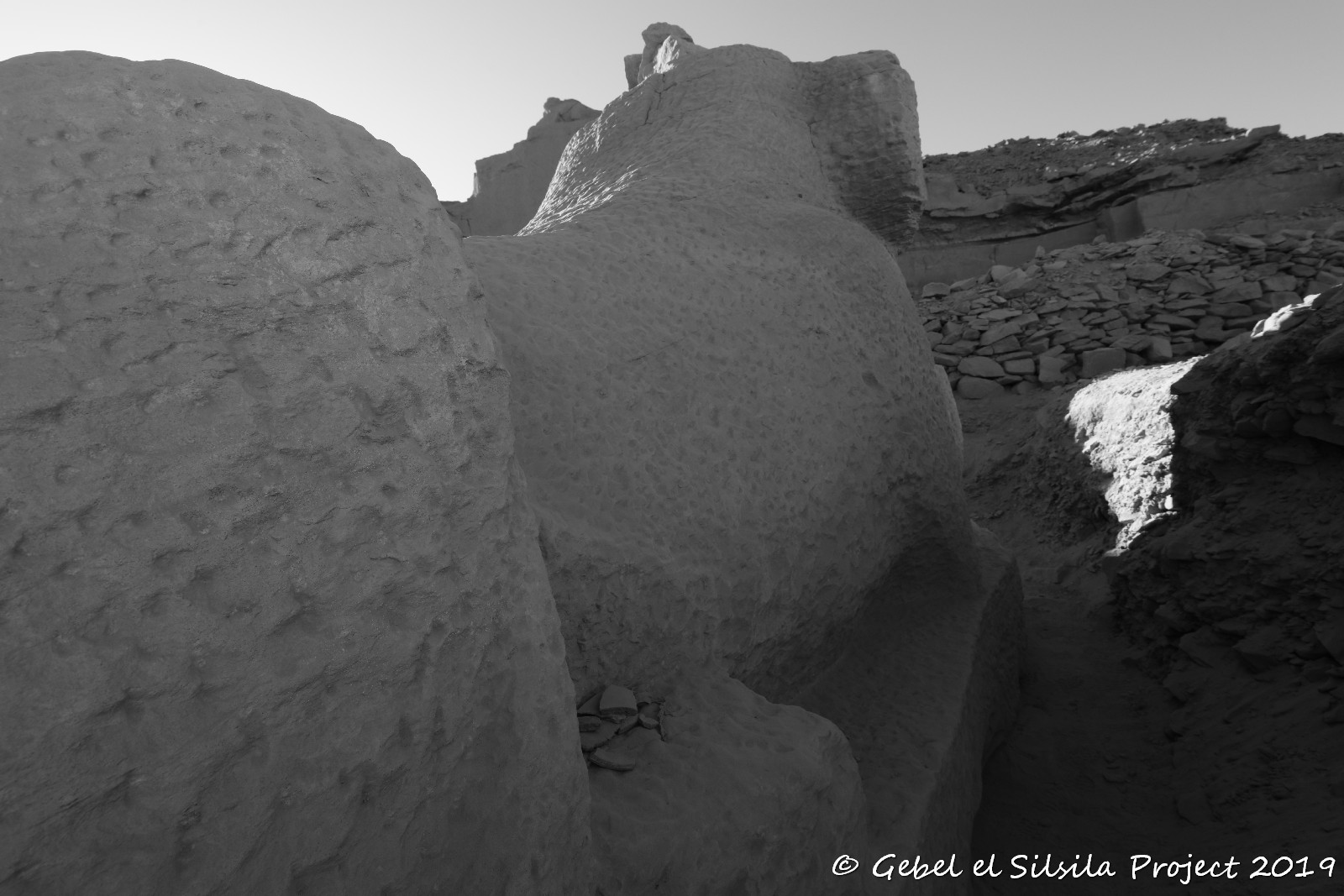
Included in the finds, a large criosphinx (ram-headed sphinx) was discovered under several meters of quarry spoil and debris. Only its head was visible before. The ram-headed sphinx measures approximately 5 m long, 3.5 m high, and 1.5 m wide, and was carved in a style comparable with the criosphinxes to the south of Khonsu Temple at Karnak. Archaeological context suggests a date from Amenhotep III of the 18th Dynasty.

making 3D-models during excavation work
PhD scholar Moamen Saad documenting the finds with total station
During the sphinx excavations and placed up-side-down next to the large sculpture’s stomach, the team discovered a smaller practice piece of another sphinx, perhaps carved by an apprentice. Both sculptures are preserved in a rough-cut and prepared for transportation, but were likely abandoned at Gebel el-Silsila as the larger sculpture fractured. Since then, later Roman quarry activity buried the sphinxes in spoil.

Nearby the practice piece, embedded in the walls of a contemporary workshop, was also uncovered a rough-cut uraeus (coiled cobra), made to crown the head of the larger sphinx, and a blank round-top stela.


During the excavations, hundreds of hieroglyphic fragments were discovered, belonging to a destroyed Naos of Amenhotep III (Naos E), together with new sculpture fragments of the associated falcon. In addition, parts of an obelisk, including its pyramidion, were retrieved.


Pharaoh wearing the blue crown

Part of the cartouche of Amenhotep III (Neb-Maat-Re)

Fragment of winged solar disk

Included in the find is also a quarry text written in red ochre during the reign of Amenhotep III (c. 3350 years ago) at the time of the opening of the quarry, preserved with the depiction of a large scale figure. The team’s epigraphers are currently working on the text and image.

Reis Ahmed by the naos

Documenting the new quarry text

Excavations and digital recordings are scheduled to continue during the mission’s upcoming field season.

Sun crowns the second (more exposed) crio-sphinx 

The team excavating around the fallen monument


One of many fragments

showing the new discovery to the Swedish Ambassador, H.E. Jan Thesleff


The discovery was filmed by British production company Windfall Films for National Geographic Channel (The Lost Treasures of Egypt: Warrior Pharaoh Queen) airing now, and UK Channel 4 (Secrets of Egypt’s Valley of the Kings) to be aired in March.


The team would like to thank the Permanent Committee for granting us permission to continue our work at Gebel el-Silsila, to Mr. Abdel Moniem, General Director of Aswan and Nubia, as well as Dr. Mostafa Waziri, Secretary General of the Supreme Council of Antiquities . We would equally like to thank all our sponsors, patrons, family and friends who support us throughout this incredible work. Thank you!