Showing posts with label Epigraphy. Show all posts

Friday, June 23, 2023

Volume I of the Swedish Expedition to Gebel el-Silsila - the Greek inscriptions


Finally, after many years of analyses and continuous documentation, we are incredibly proud to present the first volume of our monographic series called The Swedish Expedition to Gebel el-Silsila . The first publication focuses on the Greek inscriptions on the East bank:

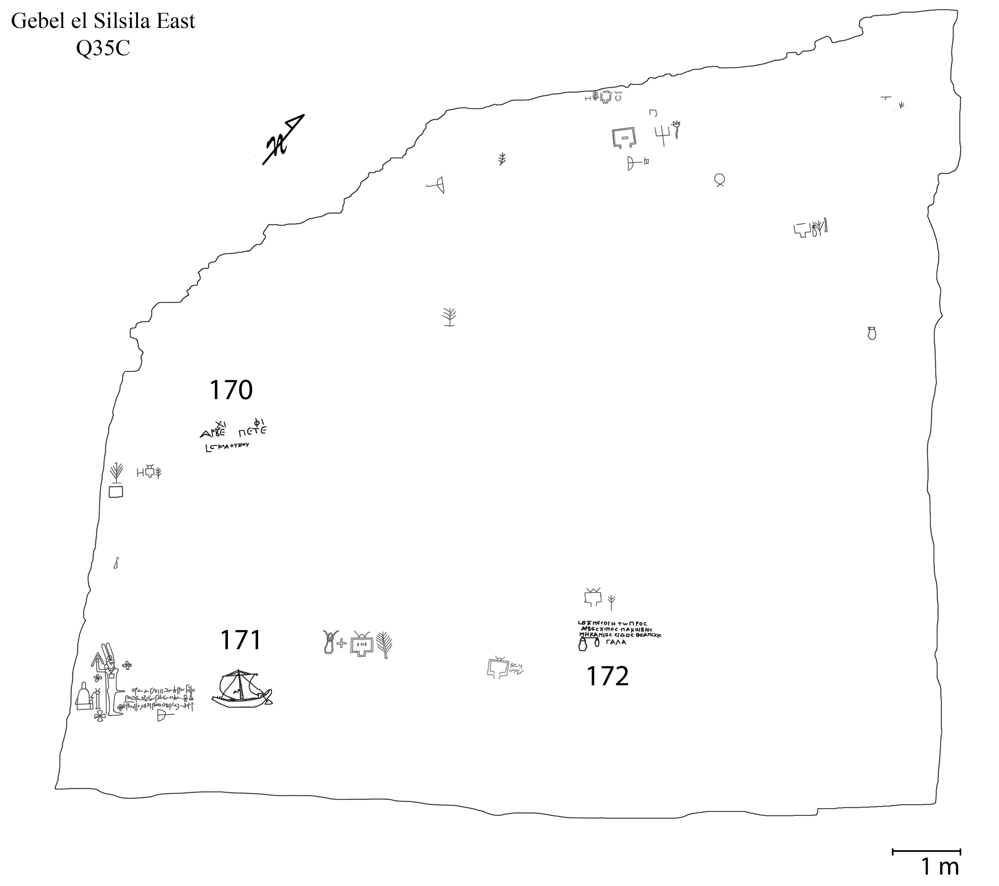
For the first time, this book presents the complete collection of Greek inscriptions of Gebel el-Silsila East – Ancient Egypt’s largest and most important sandstone quarry, including lists of names and professions of individuals involved in the quarry expeditions. The inscriptions are described, illustrated and analysed and placed within their archaeological context based on careful documentation in situ with up-to-date methodology. The work makes substantial contributions in the form of novel and improved readings and interpretations of known texts and of the new publication of texts discovered through the fieldwork. It is the first volume of three dealing with Graeco-Roman inscriptions on the east bank, with the following two volumes to cover the demotic texts and quarry marks respectively.

Based on the generous support from the Libraries of the Joint Faculties of Humanities and Theology, we have been able to publish this first volume in open access, available for free download. 


The preface reads:

The starting point for the comprehensive study of Graeco-Roman epigraphy at Gebel el-Silsila was a spontaneous visit in 2007 as part of a larger research journey, when the authors were astounded by the enormous amount of engraved symbolic quarry marks and their textual context. It became evident that the previous canon of Graeco-Roman graffiti, published by W. Spiegelberg and F. Preisgke in 1915 (Graff. Silsile), was in need of revision in order to present a complete corpus. Also, R. A. Caminos’ collated material and any hypotheses based thereon remained unpublished and unavailable for the public. For this, J. Ward and M. Nilsson made a series of field surveys in the following years and, at the time of the Egyptian revolution (2011), they had accumulated more than 3000 quarry marks and nearly 800 Greek and demotic textual graffiti. Following new regulations in 2012, they were granted the concession to lead a new epigraphic expedition. The first field season took place in September 2012, where they were joined by A. Almásy as demotist, Shihat Mohammadin as driver/cook/helper of all kinds and Mr. Ashraf as the assigned inspector. The documentation continued during the following three years in the field, followed by post-processing in the office. The current monograph is the first volume of three dealing with Graeco-Roman epigraphy on the east bank of Gebel el-Silsila. The following two volumes will cover the demotic texts and quarry marks respectively. Demotic texts and quarry marks will be included within the current volume as contextual documents, but will not receive special commentary, which is reserved for their respective publications.

The authors would like to thank the Permanent Committee and the Ministry of Tourism and Antiquities, Dr. Mostafa Waziri and Dr. Khaled El-Anani, for granting the concession to work at Gebel el-Silsila. Special gratitude needs to be offered to Dr. Abdel Moniem, General Director of Aswan and Nubia, who put at the disposal of the expedition his generosity, understanding, and efficiency. His official director Mr. Mostafa Bedawi, and all the inspectors, especially Ashraf Mohamed, Mohamed Ibrahim and Mohamed Mohsen, have been nothing but supportive and helpful and are considered part of the ‘Silsila family’. This is true also for the entire Silsila team and our respective families! We owe special gratitude to Prof. Willy Clarysse, Dr. Michael Zellmann-Rohrer and Mr. Cary Martin for their valuable comments, advice and proof reading, without which this volume would not have been completed.

Of course, none of this work would have been possible without financial patrons, for which acknowledgement and thankfulness is due to Vetenskapsrådet (#2015-00291; #2015-00291), Riksbankens Jubileumsfond (P19-0860), Crafoordska Stiftelsen (20140509; 20160607), Gerda Henkel Stiftung (AZ 58-V-15), Vitterhetsakademin (Enboms stiftelse), Magnus Bergvalls stiftelse, Lars Hiertas Minne, HelgeAx:son Johnsons stiftelse, Birgit & Gad Rausings Stiftelse, Gunvor ochJosef Anérs Stiftelse, and Swedish Royal Academy of Sciences. 


Table of Contents

PREFACE

ABBREVIATIONS

CHAPTER 1: INTRODUCTION


Gebel el-Silsila – the site


Brief historical outline


Research history


Main objectives


Methodology


Sigla


CHAPTER 2: THE MATERIAL


Introduction


Paleographic commentary


Onomastic and prosopographic commentary


Dates, professions, and religious functions


General commentary on the chronology


Abbreviations


Singular alphabetic letters


Monograms and ligatures


The quandary of literacy


The graffiti dialogue


CHAPTER 3: THE NORTHERN QUARRIES


Introduction


Quarry 11 (Q11)


Corpus


Quarry 13 (Q13)


The inscriptions


Corpus


Quarry 14 (Q14)


The inscriptions


Corpus


Quarry 19 (Q19)


The inscriptions


Corpus


Rock Art Site 11 (RAS11)


Corpus


CHAPTER 4: Q24 – TIBERIUS’ STABLES


Introduction


Tiberius’ Stables and its administration building


The epigraphy


Quarry face ‘E’


Corpus


Quarry face ‘TS’


Corpus


CHAPTER 5: Q34 - THE MAIN QUARRY


Introduction


Archaeological overview


The Epigraphy


Contents of texts


Dedicators


Name variants and scribes


Dates, professions, and religious functions


Corpus


CHAPTER 6: THE SOUTHERN QUARRIES


Introduction


Quarry 35 (Q35 – ‘the Situla Quarry’)


Corpus


Quarry 37 (Q37 – ‘the Naos Quarry’)


The epigraphy


Corpus


Quarry 40 (Q40 and ‘commemoration road’)


Corpus


BIBLIOGRAPHY

APPENDICES

INDICES


Example images (copyright Brill & the Gebel el-Silsila Project - do not share without permit):




Monday, November 04, 2019

Back to site - Season 13 has begun!


November 2019
Well, we’re in full swing, and two weeks into Season 13 the Gebel el-Silsila team has already made some amazing discoveries!

We spent several days focusing on the site of Shatt el-Rigal located adjacent to the northern boundary of Gebel el-Silsila on the west bank.

Wadi Shatt el-Rigal   Image: Google Earth

This area, which rises high above the verdant Nile valley below, is marked by steep and rocky sun baked hills, flowing sand dunes, and jaw-dropping archaeology. Our current excavation and tentative results at Shatt el-Rigal must, for now at least, remain top secret, but stay tuned!

View of the Nile Valley from Shatt el-Rigal 

All we can show you of our excavation!
  
What we CAN tell you about is our recent exploration of Wadi Shatt el-Rigal. The wadi, Arabic for dry river bed, snakes deep into the western desert cutting through the sandstone landscape.  Wadi Shatt el-Rigal is best known for the colossal relief of Mentuhotep II, who reunited Egypt in Dynasty 12 after the 2nd intermediate period. Upon entering the wadi you need only walk several hundred meters and you are confronted with this beautiful depiction.

If, however, you venture further and look closer you will find that this place bears the marks and scars of not merely this great king, but 10,000 years of human history! The wadi shows evidence of human activity from the epipalaeolithic to the 20th century, from the earliest tick marks to trade route camel tracks, everything is here!

For thousands of years humans have left their mark in this wadi.

Trade route camel tracks are still visible (and so are dog tracks of today)! 

What differentiates this wadi from so many others is the plethora of inscriptions and rock art sites, which cover most any viably inscribable surface. There are simple peck marks, clearly defined animal depictions like giraffes (my favorite), crocodiles, ibex, birds, and more, anthropomorphic figures, geometric shapes, cartouches, kings, and gods to name just a few. 

There is another popular depiction, boats, and on this day we set out determined to walk the length of the wadi to thoroughly document the so-called boats of Hatshepsut first mentioned by Archibald Sayce in 1906. An ultimate goal for the Gebel el-Silsila team is to find, document, and analyze all of the sites. Never before has such a detailed study been conducted on all historical periods. Another goal is to answer the long debated but never answered question, why here? What was so special about this wadi that made kings and commoners alike want to leave their mark? Again, stay tuned for what we find out!

Do you see that this boat has been carved over an earlier animal depiction?

For those of you have continued to support the Gebel el-Silsila mission, we are incalculably grateful. Without that support we would not be able to further our explorations and reveal the secrets, which our beloved Madam Silsila wishes to divulge.

Thank you, and keep an eye out for future announcements!

Post and images by Tricia Coletto
Archaeologist
Gebel el-Silsila Project

Thursday, June 29, 2017

3D Inner sanctuary of the speos

For those of you who enjoy the 3D models, you will be delighted to find yet another two examples uploaded, showing the northern and southern walls of the inner sanctuary of the speos at Gebel el-Silsila.

view of the inner sanctuary and the main gods of the speos. Photo by Maria Nilsson


The long south wall of the sanctuary is decorated in sunken relief, showing almost 40 seated deities uttering wishes of well being for King Horemheb. They have been often described as an Egyptian pantheon. Turned, however, towards the end wall of the temple, they are here depicted as guests to witness a mythological mystery taking place. Smaller vignettes showing priests adoring gods were later added in an empty lower portion of the wall during the Ramesside period. The destructions visible at the left are traces of eradication or hacking done during the end of the Amarna period. They were concealed under a coating of hard 'plaster' when the wall was restored for new inscriptions.

South wall of the inner sanctuary, photo by Maria Nilsson

The northern wall offers an interesting parallel to the southern wall, It shows another 'pantheon', in fact a group of invited divinities, but standing in two registers and sculptured in true relief. The relief includes 23 figures mixing gods and goddesses. If the destructions are rather related to unfortunate modern looting attempts, some traces of ancient erasures related to the Amarna period can still be seen. The Ramesside presence is this time limited to one line of text added to the right in the lower empty space. However, a viewer with keen eyes for painted and very faded graffiti will find several traces of such too.
North wall of the inner sanctuary, photo by Maria Nilsson

Gebel el Silsila Project - Epigraphic Survey
3D Photography, modelling and anotations by Philippe Martinez, lead epigrapher for the project, CNRS, Sorbonne Universités: philippe.martinez@upmc.fr

Digital images created with plexus software by Kevin Cain (plexus-3d.com), kevin@insightdigital.org


Wednesday, June 28, 2017

3D Ramesside Royal Stelae West Bank

More amazing 3D models from Gebel el-Silsila, now showing the three royal stelae on the west bank.


The main model shows an overview of the three stelea, which are situated along the cenotaph road on the west bank of the Nile. They have been preserved between two quarried surfaces. They were erected, from south to north - or left to right - by Ramses III, Sheshonq I and Ramses IV respectively. They clearly have been the subject of a local cult and below them are to be seen the traces of the Nile flood that reached their foot annually at the beginning of the summer.


There are also individual models of the three stelae:


and 

Gebel el Silsila Project - Epigraphic Survey
Photography, modelling and anotations by Philippe Martinez, lead epigrapher of the project, CNRS, Sorbonne Universités: philippe.martinez@upmc.fr

Digital models created with plexus software by Kevin Cain (plexus-3d.com), kevin@insightdigital.org

New models from the Speos

The Silsila Team is happy to announce yet some more 3D models from within the Speos or Rock-cut temple of the west bank.

The two models show the Northern and Southern side of the Eastern wall of the sancturary, divided by the doorway.

The Northern side shows divinities related to the control of the Nile Flood and connected to Aswan and the first cataract, as well as the local site of Kheny (Silsila). It is interestingly carved in relief for the upper part and in sunken relief for the lower.

The Southern side shows divinities related to the control of the Nile Flood, this time the Osirian family connected to Abydos in Middle Egypt, but also with Nubia and the South where the Nile flood came from.

Dr Martinez in the speos


Photography, modeling and anotations by Philippe Martinez, CNRS, Sorbonne Universités, Lead Epigrapher for the Silsila Project: philippe.martinez@upmc.fr

Digital models created with plexus software by Kevin Cain (plexus-3d.com), kevin@insightdigital.org

Monday, June 19, 2017

Silsila 3D images on Sketchfab!

Dear all,
the Gebel el Silsila Team is delighted to share with you some exciting new 3D-images viewable on Sketchfab.com.

The two published models mark the beginning of a new step in the project, aiming to share with the greater audience and our wonderful, supportive followers some of the unique reproductions of various (published) monuments on site.

We hope you will enjoy as much as we do!

Model 1: Scene of Goddess Taweret suckles the king, Gebel el Silsila West Bank

The relief is situated in the rock-cut temple dating to the 18th Dynasty, and more precisely to the time of Tutankhamun/Horemheb (around 1330 BC). It shows the king as a young boy, suckling the local goddess Taweret (often shown as a hippopotamus, but here as an elegant woman), witnessed by his godly protectors Amun, King of the Gods,  Khnum, god of birth, and Sobek, the local crocodile god and companion of Taweret. Through the divine milk, the king becomes superhuman and thus has the power necessary to interact with the gods and the sacred. This ritual seems to have been part of the crowning ceremonies.

overview of the southern scene, photo: Maria Nilsson


Model 2: Horemheb presenting offerings to Amun-Ra and Mut

This relief is located in the short passage between the main hall and the sanctuary, on the northern wall of the passage, in the rock-cut temple of the West Bank. It shows King Horemheb making an offering to the Theban gods, Amun-Ra and Mut. The figures and texts are sculptured in sunken relief, usually applied for outside decoration, but then everywhere after the Amarna period.

king offering to Amun-Ra and Mut, photo: Maria Nilsson


3D Photography, Modeling and anotations: Philippe Martinez, CNRS, Sorbonne Universités, philippe.martinez@upmc.fr

Digital models created with plexus, software by Kevin Cain (plexus-3d.com), kevin@insightdigital.org

Monday, June 22, 2015

Digital documentation of the Speos at Silsila

inside the speos, looking south

Any visitor to Egypt who had the pleasure of sailing up or down the Nile past the river’s narrowest point has had the opportunity of gazing into (or even visit) the petite, but intriguing and stunning rock-cut temple on the west bank of Gebel el Silsila. This temple was epigraphically documented already during the last century by R. Caminos, who intended to publish the results as the second volume of his envisioned three monographs of the site. However, as many of you know, with his passing a large bulk of his work remained unpublished, and it was not until more recently – in year 2000 – that Ch. Thiem finally published preliminary results that supposedly were based on Caminos’ work.

the speos seen from the Nile

However, much remained to be done still, for which the current archaeological team’s Egyptologist and epigrapher – Dr. Philippe Martinez – returned to the rock-cut temple in 2014, and with results that forever would change our perception of the monument. Among the more important findings is a series of iconographic (illustrated) details that push back the chronology of the temple – with examples of images belonging to Tutankhamen, but also a Nile vessel of early 18th Dynasty date carrying an obelisk, comparable in size and style with the famous barque of Female Pharaoh Hatshepsut in Deir el Bahri – but also details that suggest a religious idiom very different from what has been proposed before. Now, this is not the place to go deeper into the various findings of Dr. Martinez, especially as a series of articles are currently prepared, but instead we will focus on the documentation that has allowed Dr. Martinez to take the epigraphic work one or a few steps further from the days of Caminos’ analogue recordings.

Dr. Martinez in action


Since 2014 Dr. Martinez has worked with traditional analogue recording methods by means of very thin acetate copies combined with digital photography and layer drawings in illustrator software. These traditional methods laid the groundwork – and still make up the larger part of the data – for the digital recording that was initiated earlier this year (2015). Thus, when Kevin Cain from American INSIGHT joined the team on site, Dr. Martinez had more or less completed the analogue 1:1 copying of the detailed illustrations and texts that decorate the sandstone walls of this small sanctuary. The main aim of Mr. Cain’s work is to complement that of traditional analogue recording methods – not only in the speos, but in various areas of the site – and the first step in their documentation of the speos was to re-photograph each and every wall and detail using both natural light and special studio lights on loan from MAFTO. 

Dr. Martinez and Mr. Cain within the speos

The idea was to build so called ‘fronto-parallel orthomosaic views’ of the inscribed walls, which allows us to view an entire wall – regardless of how wide – as one combined image. Also, such photography ‘photogrammetry’ enabled Mr. Cain to produce 3D images, to complement and aid Dr. Martinez in finding further finer details also of older, superimposed scenes.

Mr. Cain photographing inside the sanctuary

Dr. Martinez and Mr. Cain doing their magic

Below are shown some examples of Mr. Cain’s 3D reconstruction of a scene from the south jamb leading into the inner chamber of the sanctuary. 


Shown here, the 3D models incorporate 1/8 of the full image resolution, based on approximately 500 photographs in –m full, -s3, and –F3. Mr. Cain describes the images:

a) The surface re-lighted without colour: the raking lighting angle is a familiar one used frequently in     epigraphic documentation
b) The surface without colour, lighting 180^ offset from above
c) ‘X-ray’ view, highlighting mesostructured. Note that the surface carving is accented in this view.
d) ‘Radiance scaling’ shading, in which the reflected light intensities are dependent on the surface           curvature and material characteristics (INRIA). This view is intended to help represent the 3D
    surface with characteristics of a 2D line drawing.
e) The surface, re-lighted, with colour extracted from studio light photography.


Similar resolution images were produced also of one of the criosphinxes in the 18th Dynasty workshop within Quarry 15. Since the sphinx is partially hidden below sand, a complete reconstruction is not possible at this present time. 

The reconstruction(s) is based on there about 40 photographs in 1/8 source –m full, -s3, and –F3.

Key to the images:
a) Plan view, criosphinx, shaded with photography
b) Left view, criosphinx
c) Right view, criosphinx
and


d) Detail of head, without colour
e) The surface, relighted, with colour extracted from photography
f) ‘Radiance scaling’ shading, in which the reflect light intensities are dependent on the surface curvature and material characteristics: note the detail made visible in the shoulder area
g) ‘X-ray’ view indented to show surface curvature


The digital documentation will continue on site as a perfect complement to the archaeological work carried out in the field. Other examples of already recorded features on site include the stela of Amenhotep IV, the fallen naos of Amenhotep III, the re-discovered Temple of Kheny, an administrative building in Quarry 24, etc. Stay tuned for more!


Want to learn more about the awesome work of the INSIGHT team? See here or continue reading for a short summary:

INSIGHT is a California non-profit organization dedicated to documenting the human record for the benefit of researchers and the general public.  We currently focus on bringing computer vision techniques to the work of archaeologists and other researchers in the disciplines that comprise the world heritage field. INSIGHT provides a practical framework for the intelligent application of visualization for sciences and the humanities.  While INSIGHT’s foremost responsibility is to researchers, educational and museum work also an area of interest.

Cultural Heritage Visualization
Recording the past with the tools of the future, INSIGHT was founded to extend the visualization capabilities of scientists and foster education in visualization, with an emphasis on digital cultural heritage.  INSIGHT provides visualization and documentation tools to scientific fieldwork.  Staffed with specialists in both archaeology and visual computing, the INSIGHT team fills the useful role of “translator” between the normally exclusive worlds of technology and heritage.  INSIGHT provides relevant digital tools to researchers and work with specialists to develop visualizations.  Since current technologies are often too expensive for research budgets, INSIGHT believes it is crucial to provide free access to equipment and techniques on a 'pilot' basis.  INSIGHT also provides a research lens through which these digital tools can be profitably viewed.
In a world where time is running out for many heritage sites, INSIGHT is working to speed the process of site documentation.  INSIGHT both develops new tools and adapts digital documentation methods for archaeological use.  Innovative use of space sampling is at the core of all INSIGHT project work, including the use of digital photography, computer modeling, and laser scanning.